


Mount Pantokrator (about 906 m) is Corfu's highest point. You can drive up via Spartylas or Petalia to Strinilas and a final steep spur, or hike from Old Perithia in roughly two hours return for fit walkers.
Mount Pantokrator is the highest point on Corfu, at 906 metres by the most commonly cited figure, and you can reach the top either by car on a narrow mountain road or on foot, most popularly from the abandoned village of Old Perithia. At the summit you will find a monastery church, a large telecommunications mast and a small café, plus a view across the whole island to Albania and, on exceptionally clear days, Italy. Allow half a day for the drive with stops, or a full morning for the walk.
Quick facts
- Height: 906 metres (sources range from about 906 to 917 metres).
- Location: northeast Corfu, above Kassiopi, Acharavi and the northeast coast.
- Access: paved road via Strinilas; final stretch steep and narrow. Footpaths from Old Perithia and Spartylas.
- Time needed: two to four hours by car from the coast with stops; around two hours return on foot from Old Perithia for fit walkers.
- Best time: spring and autumn mornings, when the air is clearest and the heat bearable.
- Good for: views, photography, walking, a cool escape from the beaches.
Why go up
Corfu is greener and more mountainous than many visitors expect, and Pantokrator is the reason. The massif fills the northeast of the island, its slopes covered in olive groves and cypresses lower down and bare limestone and scrub higher up. From the summit you can trace the whole shape of Corfu: the lagoon at Korission far to the south, Corfu Town and its fortresses, the bays of the northeast coast and the long north shore towards Sidari. Across the strait, the Albanian mountains look close enough to touch, and the town of Saranda is easy to pick out.
In antiquity the mountain was called Istoni. Its modern name comes from the monastery of the Pantokrator, Christ the Almighty, which still stands at the top.
The monastery at the summit
A monastery has stood on the summit since the 14th century; one widely cited date is 1347. The original buildings were destroyed in the 16th century, and the church you see today dates from around 1689, with a facade added in the 19th century. Inside, the frescoes range from the 14th to the 18th century and the carved iconostasis dates from 1771, according to local descriptions. The church is dedicated to the Transfiguration of Christ, which the Orthodox Church celebrates on 6 August.
That feast is the busiest time on the mountain. Traditionally, pilgrims climb to the monastery during the first days of August, and the villages below hold their own festivities, with fairs in Strinilas on the eve and the day of the feast. If you visit in early August, expect more cars on the road and a festive atmosphere at the top. Dress respectfully if you go inside: covered shoulders and knees.
Right beside the monastery stands a tall telecommunications mast, which is visible from much of northern Corfu. It is not pretty, and it does take something away from the summit, but the views more than compensate.
Driving to the top
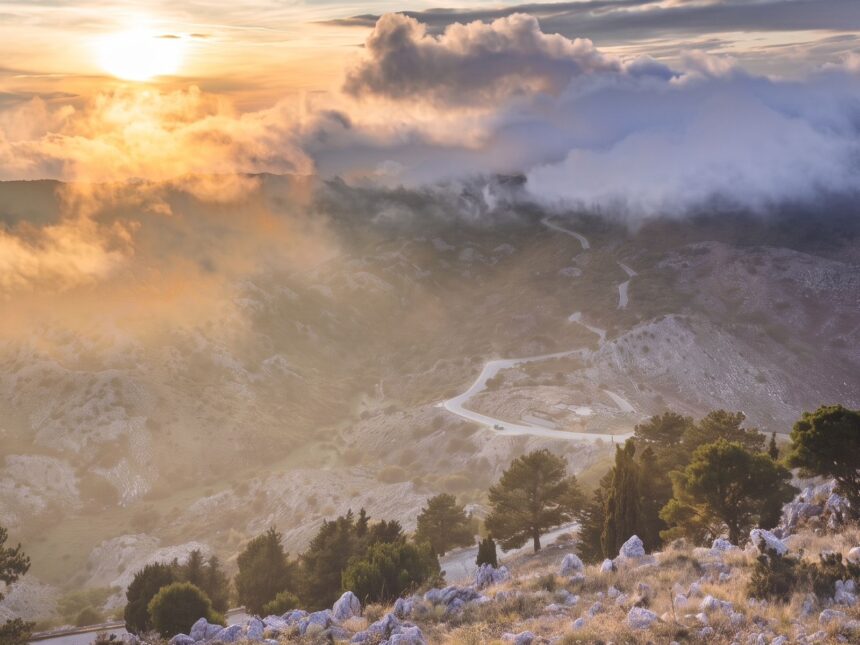
There is no single “summit road” from the coast. Instead, several mountain roads climb to the village of Strinilas, and from there a final spur of around 4.7 kilometres leads to the top. All the main approaches are paved, but they are narrow, twisty and sometimes without barriers.
From the east coast via Spartylas
The most common route starts on the coast road around Pyrgi and Agios Markos, just north of Ipsos, and climbs a long series of hairpin bends to Spartylas, a village with views back down to the sea. The road then continues through the upland villages towards Strinilas. Cyclists measure this climb at about 18 kilometres from sea level to the summit, which gives a sense of how sustained it is. In a car, allow roughly an hour from the coast to the summit without stops.
From the north coast via Petalia
From Acharavi and Roda, a road climbs through olive groves to Petalia and on to Strinilas, a distance of around 12 kilometres from the coast to Strinilas. This is a good option if you are staying on the north coast, and you can make a loop by going up one way and down the other.
The final stretch
From Strinilas the road crosses a high, open plateau of karst, rock and low scrub. The first few kilometres are easy. The last kilometre and a half is the tricky part: the surface changes to rough concrete, the gradient averages around 10 per cent and the road is barely wide enough for two cars. In summer you will meet cars coming down, so go slowly and be ready to reverse to a passing place. Some drivers prefer to park lower down and walk the final section, which takes around half an hour.
A small car is easier than a large one. Motorbikes and quad bikes are common, but the steep concrete and loose gravel near the top demand care. Parking at the summit is limited.
Hiking to the summit
From Old Perithia
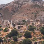
The most rewarding way up is on foot from Old Perithia, a stone village at about 440 metres that was first recorded in the 14th century and abandoned by its last families in the 1960s. Around 130 houses and several churches survive, some in ruins and some carefully restored, with tavernas around the main square in summer. Old Perithia is reached by a winding road from the north coast near Loutses, about 8 kilometres from Kassiopi.
From the village, a waymarked path climbs through the upland valley and over open, rocky slopes to meet the summit road for the last stretch. The ascent is around 470 metres. A round trip is often quoted at about two hours for fit walkers; most people should allow three or more with stops, photographs and a rest at the top. The upper section has little shade.
On the Corfu Trail
The Corfu Trail is a waymarked long-distance route of around 200 kilometres running the length of the island, and one of its northern sections crosses the Pantokrator massif. Walkers can climb from Spartylas on the east side, which is a longer and tougher day than the Old Perithia route. If you plan to walk this, carry a proper map or a GPS track, because waymarks can be faded or hidden in places.
What to expect underfoot
The paths are a mix of old mule tracks, stony footpaths and short stretches of road. Proper walking shoes with grip are essential; sandals are a bad idea on the loose limestone. In spring the slopes are full of wildflowers, and in autumn the light is sharp and clear after the first rains.
Villages worth a stop on the way
- Strinilas: the last village before the summit, at the edge of the plateau, with tavernas that serve walkers and drivers coming off the mountain.
- Spartylas: a balcony village on the east side, worth a pause for the views over the coast and the strait.
- Petalia: a small upland village on the northern route, quieter than the others.
- Old Perithia: worth a visit even if you drive to the summit, ideally combined with lunch.
When to go
Clarity is everything on Pantokrator. Summer haze often hides the Italian coast and softens the view of Albania, so early mornings in late spring, September and October give the best chance of long views. Midday in July and August is hot and exposed, especially on foot. In winter the summit can be cold, windy and wrapped in cloud, and the road may be icy on rare occasions. Late afternoon visits reward drivers with warm light over the north coast, but leave enough time to come down the mountain roads before dark.
Practical tips
- Fuel up first. There are no petrol stations on the mountain roads.
- Carry water. Bring at least a litre and a half per person for the walk; the café at the top may not always be open, particularly outside high season.
- Check the weather. If the summit is in cloud, the view will be nothing. Look at the mountain from the coast before you set off.
- Use low gears. Descending the final concrete stretch, stay in first or second gear rather than riding the brakes.
- Bring a layer. It is noticeably cooler and windier at 900 metres than on the beach.
- Combine it. A good day pairs the summit with Old Perithia and a swim in Kassiopi or Agios Stefanos in the afternoon.
Frequently Asked Questions
How high is Mount Pantokrator?
Mount Pantokrator is usually given as 906 metres, making it the highest point on Corfu. Some sources give slightly different figures, up to about 917 metres, depending on where the measurement is taken.
Can you drive to the top of Mount Pantokrator?
Yes. Paved roads climb via Spartylas or Petalia to Strinilas, and a final spur of about 4.7 km leads to the summit. The last 1.5 km is steep, narrow and rough concrete, so drive slowly and be ready to give way.
How long does it take to hike Mount Pantokrator?
From Old Perithia the round trip is often quoted at about two hours for fit walkers, with around 470 metres of ascent. Most visitors should allow three hours or more, including time at the top.
Can you see Italy from Mount Pantokrator?
On exceptionally clear days the Italian coast, roughly 130 km away, can be seen from the summit. Albania, much closer, is visible on most days unless there is heavy haze or cloud.
Is there anything at the summit of Mount Pantokrator?
The summit has the Pantokrator monastery church, rebuilt around 1689, a large telecommunications mast and a small café. Parking is limited, especially in early August during the Transfiguration pilgrimage.